LiDAR Solutions for Engineering & Construction
Access high-fidelity LiDAR and decision-ready analytics to gain a competitive edge, win more work, and increase margins.
Teren data and analytics provide:
- Digital Terrain & Topography
- Contours & Control Point Reports
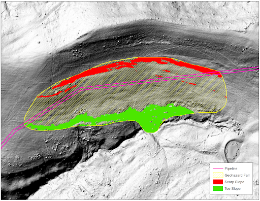
- Geohazard Identification & Ranking
- Problematic Hydrology
- Vegetation Management
- Change Detection
Fill out the form to download our brochure and access our Spring Appalachian LiDAR collection.